Showing 1–16 of 28 results
-
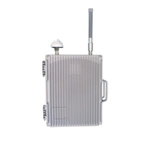
Working Mode:Radio Interference
Working band:900MHz、1.2GHz、1.5GHz、2.4GHz、5.8GHz
Interference distance:≥1500m open field (depending on model/environmental conditions)
Antenna Type:High gain directional antenna
Antenna angle:60 degrees
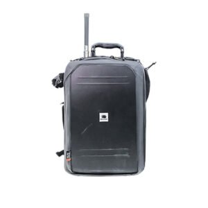
Operating time:Built-in battery , operating time up to 60 minutes
Firing power:Single channel power up to 20W.
-
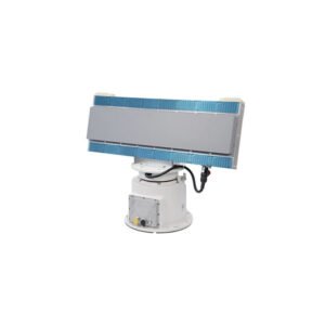
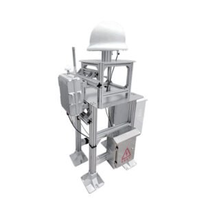
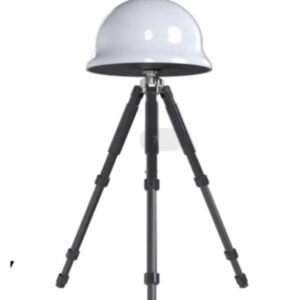
Operating system: X-band phased array system (azimuth sweep + pitch sweep)
Detection power:≥5.0km (UAV) ≥8.0km (Pedestrian) ≥10.0km (Vehicle) ≥15.0km (Boat)
Detection speed:≤0.3°(search) ≤0.3°(track)
Azimuth accuracy: ≤1.0°(search) ≤0.5°(track)
Pitch accuracy:≤5s/circle
Data rate: RJ45/1 channel 100M Ethernet
Power supply: RJ45/1 channel 100Mbps AC 220V(input) ≥250W(power consumption)
-
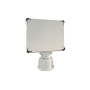
Equivalent omni-directional radiant power: ≤10mW
Frequency range:GPS:1575.42±1.023MHz, GLONASS:1602.0MHz+NX562.5kHz±511kHz (N take -7~6)
Defence radius distance: ≥500-1000m, and adjustable within 500m
Frequency tolerance:±2×10¯6
Occupied bandwidth: not greater than the frequency range
Spurious emission:30MHz-1GHz (RBW 100kHz) ≤-36dBm; 1GHz-18GHz (RBW 1MHz) ≤-30dBm
Onset time: <10s
-
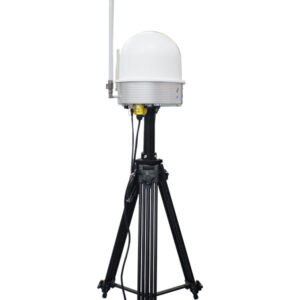
Spectrum detection
Working band: 2400~2500MHz / 5150~5975MHz
Detection radius: 1.5km (2dBi antenna/ DJI Genie 4 Pro V2.0/50m high)
3km(8dBi antenna/ DJI Genie 4Pro V2.0/100m height)
Radio interference
Operating frequency band: 900MHz, 1552MHz~1632MHz, 2390MHz~2510MHz, 5708MHz~5872MHz
Interference radius: open area ≤3KM, urban environment ≤1KM (depending on the model and environment)
Interference mode: omnidirectional 360°
Other functions: multi-target disposal
-
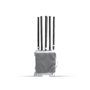
Spectrum Detection
Working band: 30-6000MHz
Detection distance: The farthest detection and positioning distance of DJI Elf 4 is 15.0KM in the open area with no obstruction on the flat ground.
Vertical take-off to the relative ground height of 100m, the farthest distance is 15.0KM.
Number of detections: ≥40 drones at one time.
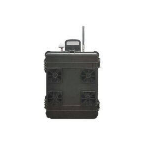
Radio interference
Operating frequency band: 900MHz, 2390MHz~2510MHz, 5708MHz~5872MHz, 1552MHz~1632MHz
Interference radius distance: ≤3000M in open area, ≤1000M in urban environment (depending on model and environment).
Interference mode: omnidirectional fixed frequency 360°
-
Detection band: 1000~1500MHz
2400~2485MHz
5150~5950MHz
Operating radius: 1km=0.6mile (external antenna up to 3km=1.8mile)
Overall Dimension: 115×56×34mm
Operating weight: 280g
Waterproof rating: IP55
Battery capacity: 29.6Wh (7.4V)
Battery life: ≥ 6 hours
-
Working Mode Radio Detection
Objects DJI series, DaoTong, Habersham, WIFI, traversing machine and other drone models
Working frequency band 2400~2500MHz / 5150~5975MHz
Detection radius distance Omni-directional antenna 700~1200m Direction-finding antenna 200~3000m (depending on the model/environment)
Direction Measuring Expansion Direction Measuring Antenna is optional
Alarm mode: light, sound
Equipment Material Alloy material
-
Support to get drone GPS coordinates, flyer GPS coordinates, return point GPS coordinates, drone model and unique serial number (regular manufacturer drone);
Detection distance is not less than the UAV mapping distance: Maximum detection distance: 18km(11miles);
Positioning accuracy: 1m(3ft)
Response delay time: 1 second;
Frequency range: 70M-6G real-time spectrum, support real-time IQ data acquisition;
Gigabit network port transmission, 5V power supply, power consumption 2W.
System continuous working time: ≥6h.
-
Equivalent omni-directional radiant power: ≤10mW
Frequency range:GPS:1575.42±1.023MHz, GLONASS:1602.0MHz+NX562.5kHz±511kHz (N take -7~6)
Defence radius distance: ≥500-1000m, and adjustable within 500m
Frequency tolerance:±2×10¯6
Occupied bandwidth: not greater than the frequency range
Spurious emission:30MHz-1GHz (RBW 100kHz) ≤-36dBm; 1GHz-18GHz (RBW 1MHz) ≤-30dBm
Onset time: <10s
-
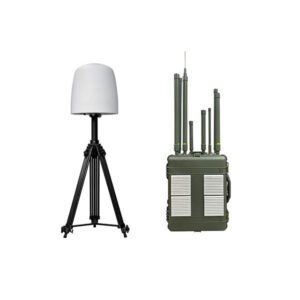
The UADS-KZC04 UAV defence system consists of a radio spectrum monitoring system and a navigation decoy system.
The radio spectrum monitoring system realises passive detection and identification of UAVs.
The navigation deception system deceptively interferes with the satellite navigation coordinate information received by UAVs that use satellite navigation and positioning to achieve the no-fly zone.
The navigation deception system deceptively interferes with the satellite navigation coordinates received by the UAV using satellite navigation and positioning to achieve the function of no-fly zone projection or area denial.
-
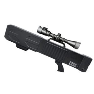
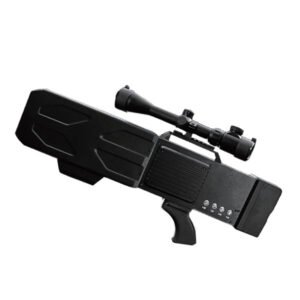
Working Mode:Radio Interference
Working band:
Jamming end:800MHz、900MHz、1.2GHz、1.5GHz、2.4GHz、5.8GHz
Detection end: 2.4GHz, 5.8GHz
Interference distance:≥2000m open field (depending on model/environmental conditions)
Antenna Type:High gain 9dB directional antenna
Antenna angle:60 degrees
Operating time:Built-in battery (24V7.5Ah), operating time up to 60 minutes
Expansion Function:Equipped with a standard rail, can be installed with scopes, night vision, law enforcement recorders, etc.
-
Detection band: 2400~2500MHz/5150~5975MHz
Detection distance:
3km=2miles(2dBi antenna/ DJI Wizard 4Pro V2.0/50m=164ft high)
6km=4miles(8dBi antenna/ DJI Wizard 4Pro V2.0/100m=328ft high)
(constant frequency without direction finding)
-
Operating frequency band 2.4GHz, 5.8GHz
Detection radius: 3Km (city)\ 5KM (open)
-
Working Mode:Radio Interference
Working band:900MHz(5.2Ghz can be replaced),1.5GHz,2.4GHz,5.8GHz
Interference distance:≥1500m open field (depending on model/environmental conditions)
Antenna Type:High gain 9dB directional antenna
Antenna angle:30 degrees
Operating time:Built-in battery (24V8Ah), operating time up to 60 minutes
Expansion Function:Equipped with a standard rail, can be installed with scopes, night vision, law enforcement recorders, etc.
-
Working Frequency Band: 30MHz~6000MHz Detection Distance The farthest detection and positioning horizontal distance of DJI Elf 4 reaches 15.0KM(10miles) in the open area with no obstruction on the flat ground, and the farthest distance is 15.0KM(10miles) when taking off vertically to a height of 100M (328ft)relative to the ground.
-
Operating system: phased array system (azimuth sweep)
Frequency band: C-band X-band S-band
Detection power: 100m~1.5km(UAV) 100m~2.0km(UAV) 150m~5.0km(UAV)
Azimuth Coverage:0°-360°
Elevation Coverage:0°-30° 0°-40° 0°-40°
Detection speed:0.5m/s~30m/s 0.5m/s~30m/s 0.5m/s~45m/s
Azimuth Accuracy ≤1.0°